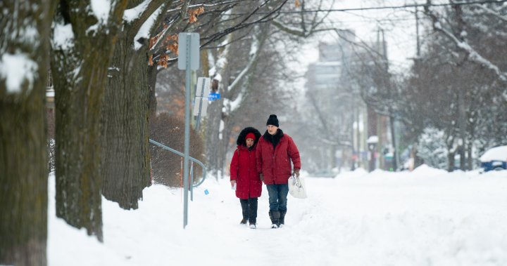
After the warmest December on record, an extreme cold wave is sweeping through Canada bringing heavy snowfall and strong winds that are forecast to continue this week.
Special weather statements and extreme cold or snowfall warnings were in place Monday in all the provinces and territories, according to Environment and Climate Change Canada.
Over the weekend, several cold temperature records were broken in Alberta, British Columbia, Saskatchewan and the Northwest Territories.
Global News meteorologist Ross Hull said “much of the country is experiencing the deep freeze” due to the cold Arctic air drifting south with the polar vortex descended.
The polar vortex is a large area of low pressure and cold air surrounding both of the Earth’s poles, according to the U.S. National Weather Service.
It’s not unusual for Canada to get episodes of polar vortices during winter, flooding down a burst of Arctic air from high latitudes that can result in a cold snap once or twice every winter, experts say.
But this current extreme cold wave, which is expected to continue in parts of the country this week, seems all the “more significant” when contrasted with how mild December was, said Geoff Coulson, a warning preparedness meteorologist with Environment Canada.
December was warmer than any previous year, European climate agency Copernicus said in its annual report released last week, confirming 2023 as the hottest year on record.
Coulson said the “mildness of December” in many parts of Canada makes this current cold outbreak “stand out.”
“What’s really noteworthy about this particular outbreak of Arctic air is just the amount of the country that’s being influenced by it in one way or another,” Coulson said in interview with Global News Monday.
The jet stream, which is a region of high winds that blows around the globe from west to east and usually confined to the north, has taken a southward departure, said Kent Moore, professor of physics at the University of Toronto Mississauga.
That’s why most of Canada is experiencing frigid conditions.
Get the latest National news.
Sent to your email, every day.
“These undulations happen once or twice every winter (and) we get a cold snap, so that’s what we’re in right now,” Moore said in an interview with Global News.
Sometimes the cold air can move in quick waves before it leaves an area, but this is a “prolonged event,” especially for the Prairie provinces, Hull said.
Climate change is also likely playing a role here, affecting the way the jet stream is behaving and making the cold snap longer than usual, Moore said.
“There is some evidence that as we warm the planet up, these cold snaps or these polar vortices outbreaks are becoming more common,” he said.
After three consecutive La Niña winters, a moderate El Niño is now well established in the central Pacific Ocean.
During El Niño years, trade winds weaken and the Pacific Ocean tends to release more heat into the atmosphere, making areas in the northern U.S. and Canada drier and warmer than usual.
This warmer-than-normal water affects the jet stream and weather patterns around the planet and often leads to milder and less snowy winters in Canada.
But each El Niño can behave differently — which is what this one appears to be doing, Hull said.
“We did think that this El Niño was going to be different.”
Some of the signatures meteorologists were looking at when it comes to ocean temperatures and some aspects of this particular El Nino were not a classic El Nino, Hull added.
“We did expect some bouts of colder air with this winter forecast, so that’s what we’re experiencing right now.”
The influence of El Niño also tends to be based on a number of months when you look at the average temperature, said Coulson, adding that there can still be a “a lot of variability” in the weather from day to day and week to week.
“El Niño will still continue to be an influence on our weather going forward for the rest of the winter,” Coulson said.
“We could see temperatures returning to a milder than normal conditions for many parts of the country as we get into the end of January and into the first part of February.”
Moore said Canada has probably already experienced the peak cold of this winter.
“We’ll still get some of these cold snaps, but I don’t expect them to be as severe as this one. This one is really quite dramatic.”
— with files from Global News’ Anthony Farnell.
© 2024 Global News, a division of Corus Entertainment Inc.


